![]()
![]()

Utah Wandering
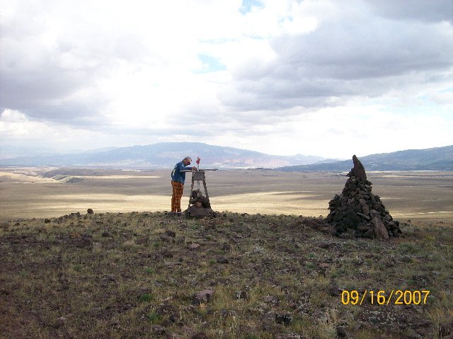 |
......a large amount of not very much. Here's a photo that Nancy took of me investigating a cairn of rocks that was way the heck up on top of a hill out in the middle of no damn place. Wanna know how for out we were? We hadn't seen anything moving -- man-made nor living critter - for at least an hour. There we were, on top of this lonely hill, cold and windy -- when Nancy saw some movement. It turned out to be a cowboy (well, maybe, but he was wearing a cowboy hat and riding a horse and had a pair of dogs with him) coming up the two-track road we had taken (steep, had to use four-wheel-drive) to the top. Hey, we didn't know any better but that it might be his (or his boss's property), so we got back in the truck and meandered back down the hill. As I remember he didn't wave as we went past. |
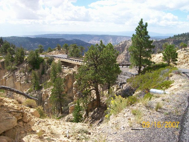 |
About twenty miles of dirt road (part of which wasn't on the flat -- it was hilly as the dickens and twisty and sort of scary) we turned east and headed for the (ready for this subtle name?) "Box Death Hollow Wilderness Area". Boyoboy, were we ever out there now! And soon we came upon this sight -- and believe it or else, I'd heard of it before. Looks pretty far out and isolated, hey? |
 |
Here's the name of the bridge -- and it does sum up the neighborhood quite well. By the way, thanks to my buddy Gilly (Ron Gilmore) for telling me about this bridge. I don't know if we would have ventured to it if it weren't for him. |
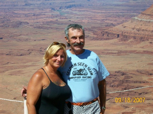 |
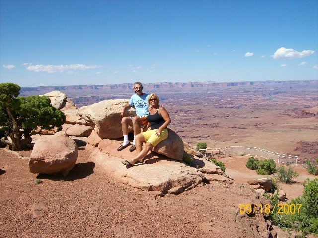
After our trip through the Box Death Pleasure Area (was that what I called it?) we camped for a night on the Burr Trail -- a road, mostly paved with 20 miles or so of gravel -- at a fabulous location in the way-out-back. We were at 6,000 feet, with the tent near the top of a hill - in the sandy soil. Nice place, and when - during the middle of the night - a thunderstorm rolled through -- I was very glad that I had done a good job staking down the tent. We didn't blow away, and we didn't get wet during the downpours that accompanied the storm. Too bad I didn't take any photos up there (I did, but with a film camera, and I don't have the prints in the computer so can't add them here). Anyway, the next day we followed the Burr Trail for miles and miles, crossing over quite a few washes that are usually dry - but were then wet with runoff from last nights' storm. Then -- about twenty miles from the previous place where we could have turned, and only about five miles from the paved road we were trying to achieve -- that's when we found a wash that had two or three feet of fast-running water in it. No way we could get across that, so I turned the truck around -- and promptly got stuck in the mud on the side of the road. Yeah, this is gonna be great -- it'd been miles since we'd had cell phone service, miles since we saw anything moving, and we're stuck! I kept my wits about me and was able to drive out of the muck after a few minutes of worrying, and so we headed back to that previous turn. A couple of miles later there was another road -- and only two miles down it is where we were met by a truck coming towards us. The driver proclaimed "No, don't go down this one, either -- it's washed out, too!" So back we went, and drove many more gravel miles 'til we arrived at an intersection with Utah Highway 24, where we turned east and headed into Hanksville. Whew! From Hanksville we went across the Glen Canyon Park area at Hite's Landing, stayed in Monticello, and the next day visited Canyonlands National Park. Hey, you were wondering if I was ever going to name the location where we had this photo taken, weren't you? When we had the tourists take the shot we told them that they were taking what would probably be our "Christmas Card" photo for the year -- and sure enough, it turned out well enough that we did use it (as one of two shots on the card). You can see about twenty miles in this card. Pretty nice scenery, hey? |
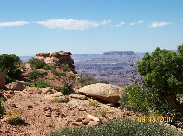 |
We took this photo at Canyonlands, too, just so you could see the distant butte and the horizon a long ways away, and the blue sky. If I had found the perfect juniper I'd show you how the juniper berries were ripe. Very pretty blue berries, and fat, too. I mention this in case you want to make your own gin -- here's a good place to get the berries. |
 |
One last photo from Canyonlands. It's a popular place for folks to hike and camp in the wilderness, or for some to visit and drive their 4x4 off-road vehicles and ATVs and other things that leave semi-permanent tracks in the wilderness. By the way, there are two entrances to Canyonlands Park -- the one we used is on the southeast corner of the park, and the other -- which is the more used one -- is up near Moab. The scenery there is somewhat different, as I remember -- more like a view of the Grand Canyon, but early in the construction phase of the G.C. If you have the chance -- visit Utah. It's very scenic. |